We start the day by driving to Koto Gadang, Koto Gadang is a village between Singgalang Mountain and Ngarai
Sianok. It is located 920-950 above sea levels. Starting with farmers and gold-smith, this village has lots of scholar with high education and respected leaders. This place is very popular for its silver-smiths.
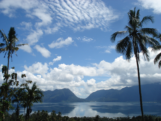
We move to Puncak Lawang Lawang, a name of a plateau in Agam District located 1.210 meters above sea level. From this place, we can view the blue Lake Maninjau. From here we can see the whole view of Lake Maninjau. In the colonial era, it was used as a resting place of the Dutch nobility. Nowadays often used for international class paragliding championship because it is one of the best spots in Southeast Asia. To achieve the Puncak Lawang, we will pass the 44-turns (Kelok 44).
Look at this breathtaking view of Lake Maninjau. Lake Maninjau has an area of approximately 16 km long and 7 km wide. The average depth is 105 m, with a maximum depth of 165 m. The natural outlet for excess water is the Antokan river, located on the west side of the lake. It is the only lake in Sumatra which has a natural outlet to the west coast. Most of the people who live around Lake Maninjau are ethnically Minangkabau. Villages on the shores of the lake include Maninjau and Bayur.
The Maninjau caldera was formed by a volcanic eruption estimated to have occurred around 52,000 years ago. Deposits from the eruption have been found in a radial distribution around Maninjau extending up to 50 km to the east, 75 km to the southeast, and west to the present coastline. The caldera has a length of 20 km and a width of 8 km.
Today we are trekking from up the viewing point to down the lake...
Villagers house near the lake...
###
Ngarai Sianok / Sianok Canyon is a steep valley (ravine) located in the border town of Bukittinggi, it has a very beautiful view and also one of the attractions mainstay of the province.
Sianok Canyon's ravine is about 100 m depth, stretching along 15 km with a width of about 200 m, and is part of the fault which separates the island of Sumatra in half lengthwise. This fault forming a steep wall, even perpendicular and form a green valley-the result of decreased movement of the earth (sinklinal) -which fed Sianok rod (rod means river, in Minangkabau language) that the water is clear. In the Dutch colonial era, this gap also known as karbouwengat or buffalo sanget, because the number of free-living wild buffalo in the bottom of the canyon.
Sianok rods can now be forded by using canoes and kayaks. On the river banks we can still see many rare plants such as Rafflesia and medicinal plants, and there are some wild animals such as long-tailed monkey, gibbon, mitered, deer, wild boar, leopard, and tapir (its a large herbivorous mammal, similar in shape to a pig, with a short, prehensile snout).


